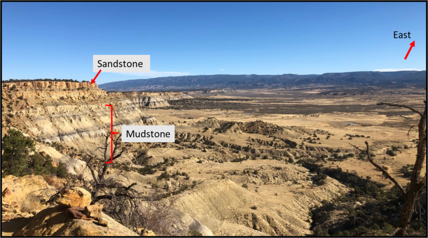
Hello BackYard Geology readers!!! A little over a week ago I embarked on an incredible outdoor journey and the landscape I observed inspired this week’s post! Allow me to explain; on Nov. 6th I ran my first ultramarathon in northern New Mexico along a portion of the continental divide trail! It was a roughly 35 mile out and back race which meant we finished where we started (18 miles South, turned around, and ran 18 miles North), and in this case the trail head was off of route 197 slightly south of the town of Cuba, NM. The rocks and vistas I saw along this 35 mile trek told an interesting story of weathering and erosion which will be the highlight of this post!
Geology of the DeadMan’s Peak Ultramarathon Trail
Below is the approximate location of the trail as it intersects several different geologic rock layers (or units) ranging in ages from approximately 83 million years to 56 million years old. The rocks are all sedimentary and are made up of sandstones, mudstones, shale, small coal deposits, and conglomerates1.
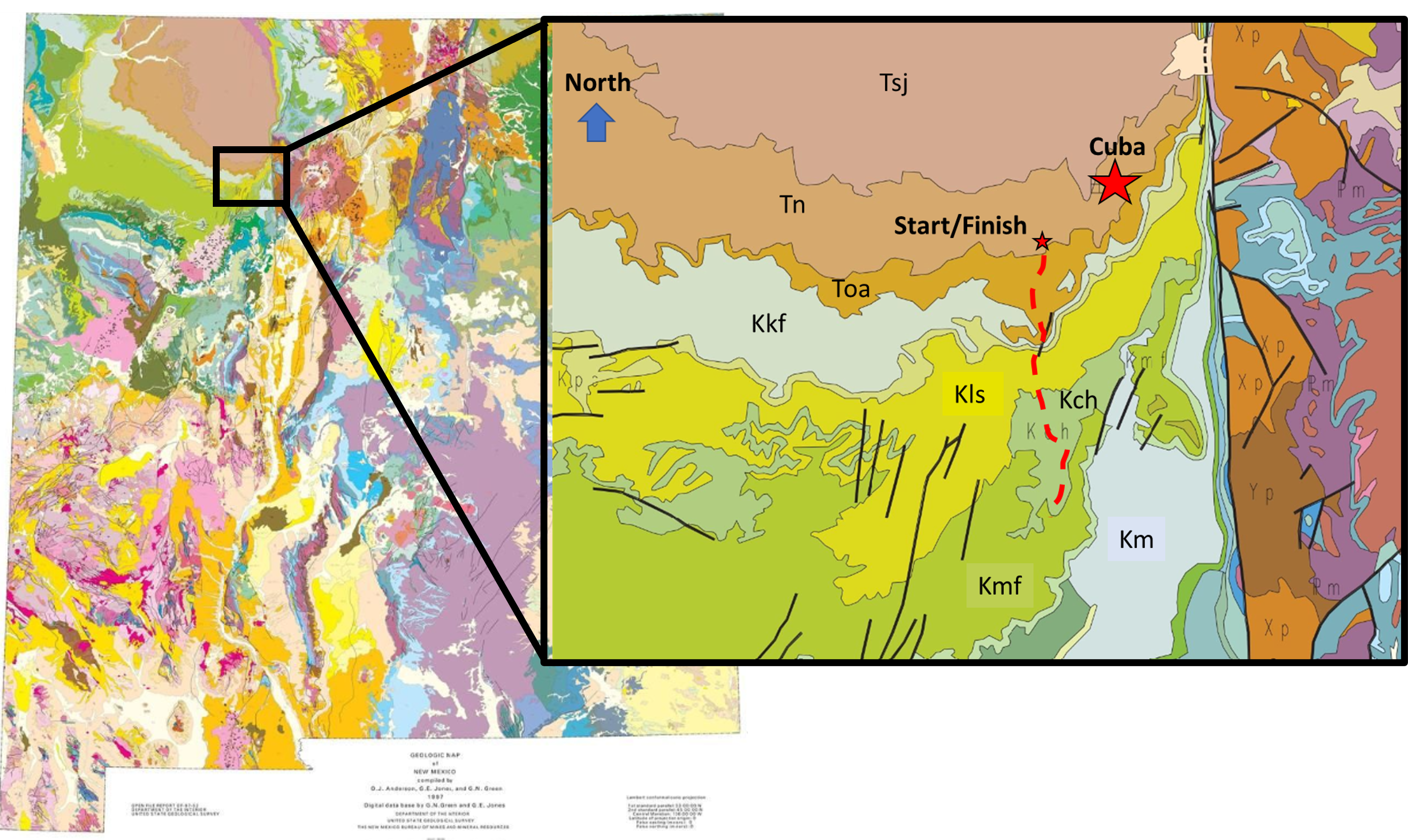
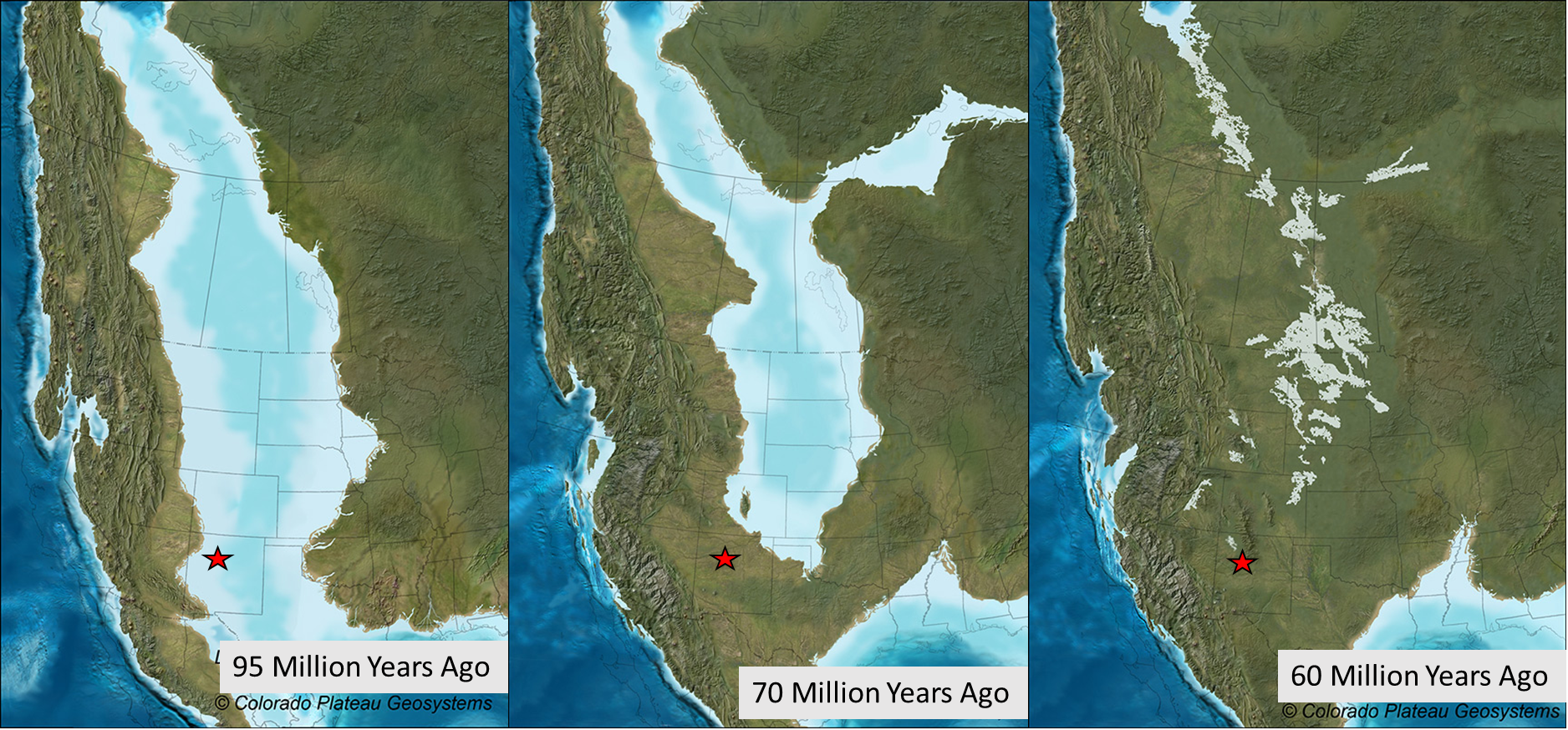
The sequence of these rocks represent a unique time in New Mexico’s geologic past and it was really exciting running through geologic history (well, mostly, until about mile 25 when I was exhausted). If we stacked this sequence of rocks vertically in a column, we could visually see the oldest rocks underneath the younger rocks. This is called a stratigraphic column and is used prominently in geology to represent layers of rocks. If we are out hiking in the field and we travel from older rocks to younger rocks, we often say we are walking ‘up section’. In my case, I traveled ‘down section’ so I started out in younger sandstones and shales and made my way down into older shale, sandstone, and coal deposits. In the Cretaceous Period, NM was covered by a shallow continental seaway, called the Western Interior Seaway (see our posts on gypsum and shark teeth fossils where we discuss this seaway!)3. Toward the end of the Cretaceous the sea retreated and the environment transitioned to that of land deposits; our Tertiary rocks represent this environment (the rock units on the map that start with the letter T). So in short, I ran from the shore out to sea and back again.
Running from land to sea to land again through millions of years of geologic time was incredible, but seeing how the landscape had been further modified from more recent geologic events was what really made for some stunning views (and an exhausting second half of my race)!
Differential Erosion
Differential erosion is what provided me with stunning views and rather difficult climbs. Let’s first break down what erosion is. Erosion is the process in which rocks are broken down into smaller pieces and transported by either wind, water, ice, or some combination of the three. Here in NM the primary eroders are wind and water that act together to form the stunning landscapes in our sedimentary rocks! Differential erosion refers to erosional differences in our rocks based on what they are made of. Some rocks are more resistant to erosion and are broken down less easily than others. Rocks such as sandstone are typically made up of harder minerals (like quartz) cemented together so they tend to last longer. Rocks such as shales and mudstones are made up of softer minerals (clay) that are not well cemented together making them prone to break down more easily. So we often refer to our sandstones as ‘cliff formers’ and the shales/mudstones as ‘slope formers’. Over time with continued exposure to the wind and rain beautiful mesas will form. Here in NM we have many examples of mesas where the shales and mudstones are sitting underneath the harder sandstones (as we would expect). This is the exact set up that my race traveled through.
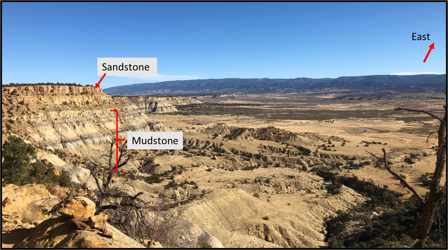
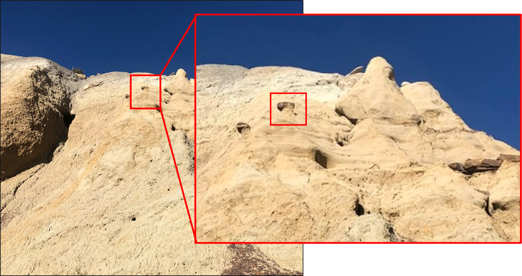
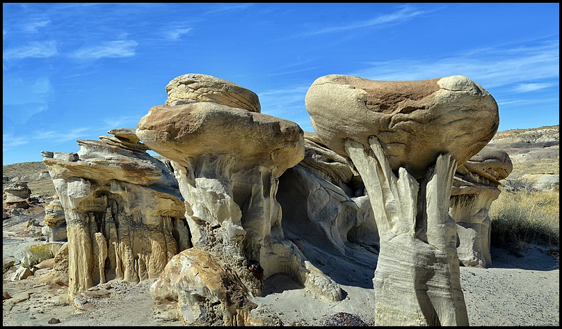
At the base of this mesa, as I stopped for a quick snack break, I noticed another, smaller scale example of differential erosion – the formation of hoodoos! The same principles apply, there is a resistant rock on top protecting the lesser resistant material underneath from completely eroding away. Instead of forming a mesa, a small spire forms, like the one below.
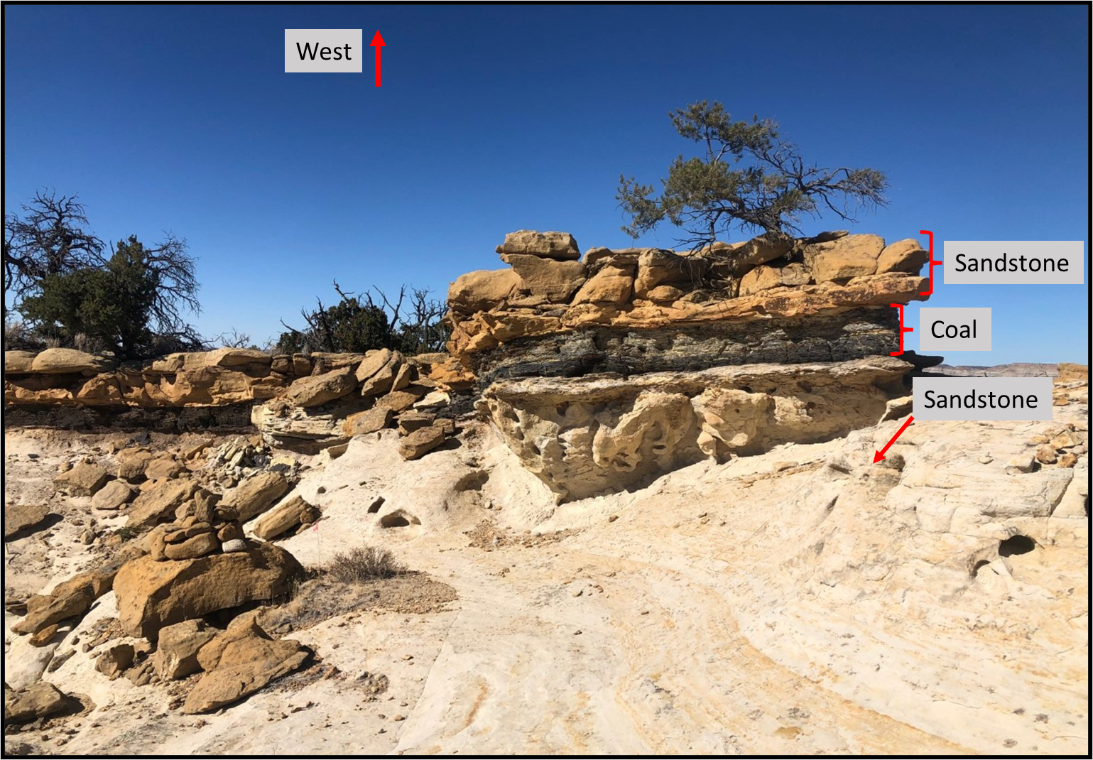
The second mesa we had to tackle turned out to be a series of climbs and descents, but I moved into older rocks and almost ‘out to sea’. I came across another excellent example of differential erosion while climbing this second mesa. There are two sandstones protecting a layer of coal. The image below shows this example. Even as we look at these sandstones we can notice how one has been more eroded away than the other.
After I turned around at the halfway point, I traveled over most of these areas in the dark, but I will say, as I made my way toward the finish line I could literally feel the differential erosion as I climbed and descended (Although I am not sure if at that point in the race I enjoyed it any longer…). By the end of my race I was very happy to be done climbing mesas, but in awe of the incredible adventure they had given me that day!
References:
1Childs, O.E., 1985, Correlation of stratigraphic units of North America: COSUNA. AAPG Bulletin, v. 69, p. 173-180. Apart of the Macrostrat.org database: https://macrostrat.org/sift/#/column/489
2Green, G.N., and Jones, G.E., 1997, Digital geologic map of New Mexico: U.S. Geological Survey, Open-File Report OF-97-52, scale 1:500,000. https://ngmdb.usgs.gov/ngm-bin/pdp/zui_viewer.pl?id=61478
3Lowery, C.M., Leckie, R.M., Bryant, R., Elderback, K., Parker, A., Polyak, D. E., Schmidt, M., Snoeyenbos-West, O., and Sterzinar, E., 2018, The Late Cretaceous Western Interior Seaway as a model for oxygenation change in epicontinental restricted basins: Earth-Science Reviews, v. 177, p. 545-564.

